
ArcGIS/ Esri
PaleoPro is an extension to ArcGIS Pro from Esri which enables geoscientists, GIS professionals and academics to incorporate geologic time into their GIS. With PaleoGIS, users visualize their own data in a plate tectonics and paleographic context.
Excerpt from Wikipedia Article, “ArcGIS“
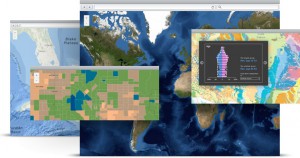
Esri’s ArcGIS is a geographic information system (GIS) for working with maps and geographic information. It is used for: creating and using maps; compiling geographic data; analyzing mapped information; sharing and discovering geographic information; using maps and geographic information in a range of applications; and managing geographic information in a database. The system provides an infrastructure for making maps and geographic information available throughout an organization, across a community, and openly on the Web. (ArcGIS, 2013)
More specifically, PaleoPro is an extension to the ArcGIS Pro component of the ArcGIS suite.
Excerpt from Wikipedia Article, “ArcMap“
ArcMap is the main component of Esri’s ArcGIS suite of geospatial processing programs, and is used primarily to view, edit, create, and analyze geospatial data. ArcMap allows the user to explore data within a data set, symbolize features accordingly, and create maps. (ArcMap, 2013)